Hello,
we have used the new DJI Phantom RTK drone to map a large quarry. We used the DJI base station and positioned it on a well known point. As we are located in southern germany we normally use the german coordinates - Gauss-Krüger 3. However, we had to measure the location of the base station in WGS84and know have the whole project saved as WGS84 in Agisoft.
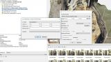
For the creation of the mine plan we have to transfer the WGS84 coordinates into Gauss-Krüger. While it is possible to transform them into ETRS89, it does not work into Gaus-Krüger. We rechecked the coordinates and they were all wrong.
I suggest that the transform parameters are not correct. Does anyone knows how to get the right parameters for
Versatz/Offset, Rotation, Skalierung/Scaling and especially Geoidhöhe/Geoid height ?
 Topic: Transformation parameters UTM in Gaus-Krüger DHHN (Read 1692 times)