Hello Guys,
first i want to thank the developers and their team for this great piece of software.
Currently I am using Photoscan to construct a 3D model of a little historic tower (4 x 4x 6 m).
There are 147 images taken and in addition 14 natural points (corners) surveyed with a total station, so their accuracy is pretty high.
I placed the markers in all pictures, entered their coordinates (local) and ran the alignment with these. The RMS of the chunk is at a satisfying 0,5 px.
But when I look in the Reference tab, the markers have a very high error, mostly in X and Z axis (see screenshot)
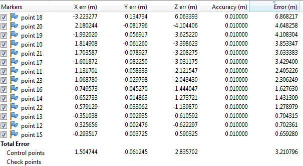
- I cant explain myself that, i placed them very accurately in every picture and doublechecked that. So maybe someone of you can do that.
- Also, in the Reference Tab there are no coordinates and thus no errors of the cameras (images). Do I need to enter the coordinates for each camera maunually (i didn't survey these) or how do I get to them?
- In the Referene Settings, does the value for "Camera accuracy (m)" mean at which accuracy the positions of each camera has been surveyed?
- Is it recommended to load the markers after the alignment and optimisation?
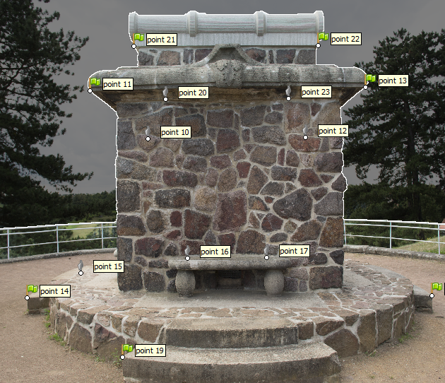
Image: placed markers in one of the 147 images
Thank you in advance!
Manuel
 Topic: Very high error of markers (Read 6090 times)